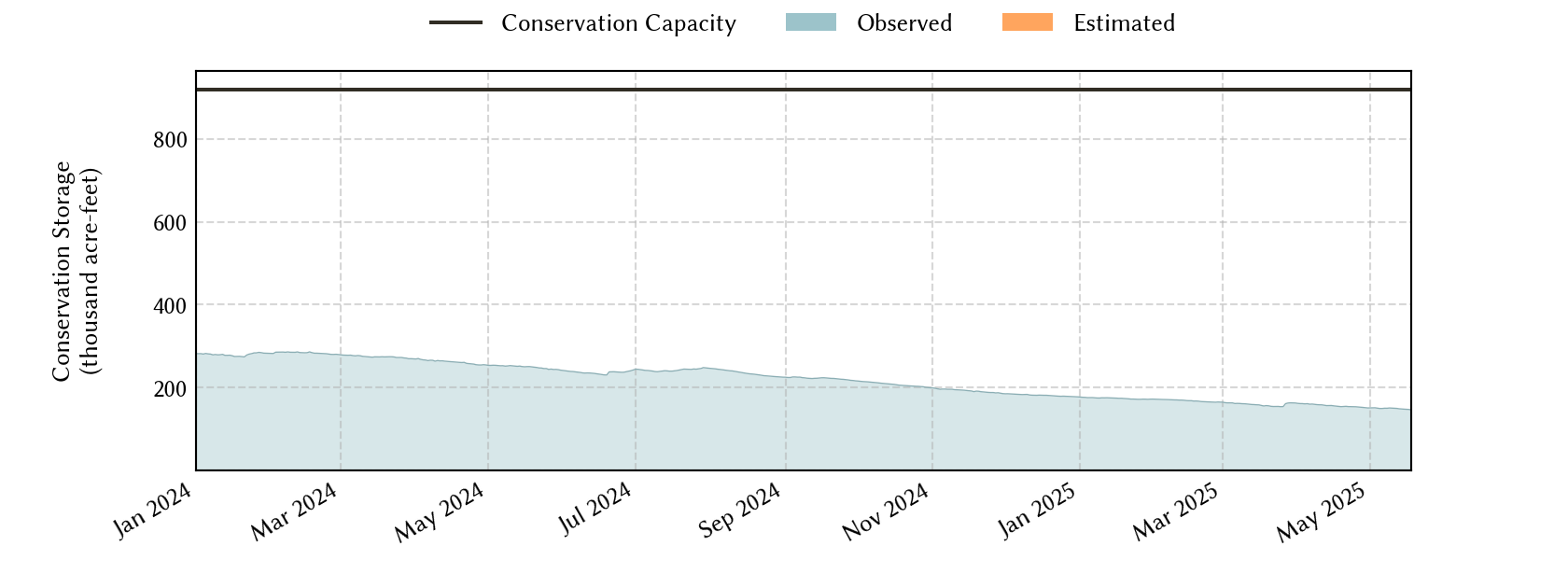
Coastal-Bend Planning Region Reservoirs: Monitored Water Supply Reservoirs are 16.0% full on 2025-05-17


Historical Data
| Date | Percent Full |
Reservoir Storage (acre-ft) |
Conservation Storage (acre-ft) |
Conservation Capacity (acre-ft) |
|
|---|---|---|---|---|---|
| Today | 2025-05-17 | 16.0 | 147,451 | 147,172 | 918,882 |
| Yesterday | 2025-05-16 | 16.1 | 147,771 | 147,492 | 918,882 |
| 2 days ago | 2025-05-15 | 16.1 | 148,092 | 147,813 | 918,882 |
| 1 week ago | 2025-05-10 | 16.4 | 150,581 | 150,302 | 918,882 |
| 1 month ago | 2025-04-17 | 16.9 | 155,404 | 155,125 | 918,882 |
| 3 months ago | 2025-02-17 | 18.2 | 167,634 | 167,355 | 918,882 |
| 6 months ago | 2024-11-17 | 20.8 | 191,863 | 191,584 | 918,882 |
| 1 year ago | 2024-05-17 | 27.3 | 250,726 | 250,447 | 918,882 |
*
Percent Full is based on Conservation Storage and Conservation Capacity and doesn't account for storage in flood pool.
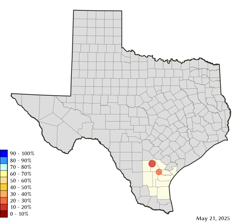
Area Map
Reservoir Storage
| Reservoir | Type | Percent Full |
Water Level (ft) |
Height Above Conservation Pool (ft) |
Reservoir Storage (acre-ft) |
Conservation Storage (acre-ft) |
Conservation Capacity (acre-ft) |
Surface Area (acres) |
|---|---|---|---|---|---|---|---|---|
| Choke Canyon |

|
14.3 | 185.50 | -35.00 | 94,479 | 94,478 | 662,820 | 8,036 |
| Corpus Christi |
|
20.6 | 79.75 | -14.25 | 52,972 | 52,694 | 256,062 | 7,906 |